The Hidden GIS Errors That Can Disqualify an ARR Project
Imagine this: your team has spent two years on an Afforestation, Reforestation, and Revegetation (ARR) project. You’ve navigated complex community consultations, perfected carbon models, and conducted exhaustive land assessments. But when you finally submit for third-party verification, the project is sent back with a sea of red ink.
The culprit? A “minor” Geographic Information System (GIS) error that accidentally inflated your eligible project area.
In the world of carbon credits, spatial data is the bedrock of credibility. Whether you are working under Verra’s VCS, the Gold Standard, or a national scheme, auditors scrutinize your GIS layers line by line. A single misaligned coordinate or an outdated satellite image can invalidate months of work.
To ensure your ARR project stands up to scrutiny, you must navigate these four critical geospatial pitfalls.
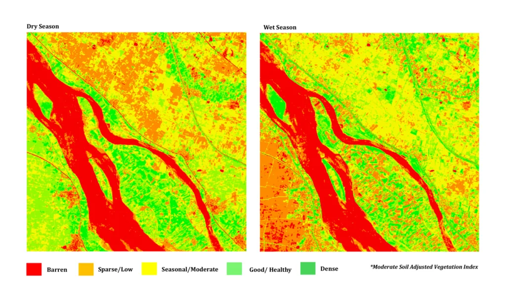
1. How Seasonal Variations Can Mislead Land Eligibility Assessments
Satellite imagery provides a snapshot in time, but landscapes are dynamic. This is perhaps the most deceptive error in ARR projects because the resulting maps may look technically “correct” even when the data is fundamentally flawed.
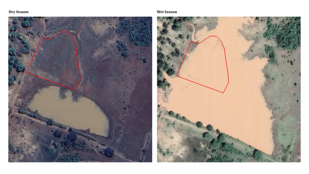
Consider an assessment of peninsular India using imagery from the dry season (March). During this time, seasonal water tanks appear as bare earth, and riparian strips look sparse. To a GIS technician sitting in an office, this may seem like prime, empty land for planting. However, when a validator reviews a wet-season composite, those “empty” spots reappear as active wetlands or existing tree cover.
If your project boundary is drawn based on a single season, your carbon estimates will likely collapse during verification
The Fix: Use multi-seasonal composites. Ensure your GIS team understands the phenology (seasonal cycles) of the landscape, rather than just relying solely on high-resolution snapshots captured at the wrong time of year.
If your project boundary is drawn based on a single season, your carbon estimates will likely collapse during verification
2. Wrong Coordinate Systems and Projections
The Earth is (roughly) spherical, but maps are flat. The process of representing the globe on a flat surface is called “projection.” Using the wrong Coordinate Reference System (CRS) is a foundational error that affects every calculation.
Many teams mistakenly use Geographic Coordinate Systems like WGS84 (measured in degrees) for area calculations. While great for GPS navigation, degrees are not a reliable unit for measuring land area. For accurate carbon accounting, you must use Projected Coordinate Systems, such as UTM (Universal Transverse Mercator) zones.
The Stakes: A seemingly tiny 5% margin of error on a 10,000-hectare project results in 500 “phantom” hectares. In the carbon market, that represents tens of thousands of tonnes of CO₂ that don’t exist, a discrepancy that can lead to total disqualification.
3. Boundary Digitizing and Topology Errors
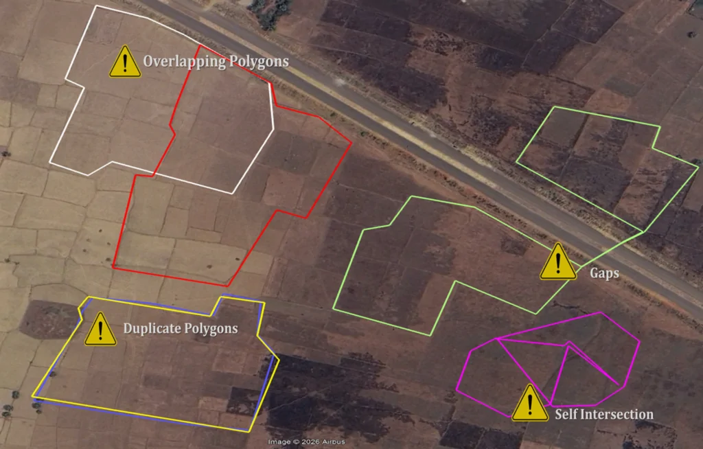
Digitizing a map may sound straightforward, but “topology errors” are the invisible gremlins of GIS. These are structural flaws in the vector data, such as:
- Overlaps: Two land parcels claiming the same area
- Gaps: “Sliver polygons” or tiny uncounted spaces between boundaries
- Self-intersections: Polygons that loop back on themselves, confusing the software
These errors often creep in when merging datasets from different government agencies or switching between software like ArcGIS and QGIS. While they may not be visible to the naked eye on a standard map, automated validation tools used by auditors will flag them instantly.
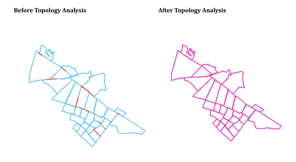
The Fix: Implement a mandatory “topology clean” in your workflow. Use automated geometry checkers to resolve every intersection and gap before the data ever leaves your desk.
If your project boundary is drawn based on a single season, your carbon estimates will likely collapse during verification
4. Missing or Incorrect Exclusion Zone Layers
In ARR, knowing where not to plant is just as important as knowing where to plant. Every carbon standard has strict “exclusion zones” that must be carved out of your project boundary:
- Infrastructure: Roads, settlements, and power lines.
- Hydrology: Permanent waterbodies and seasonal wetlands.
- Legal Protections: Existing old-growth forests or restricted conservation zones.
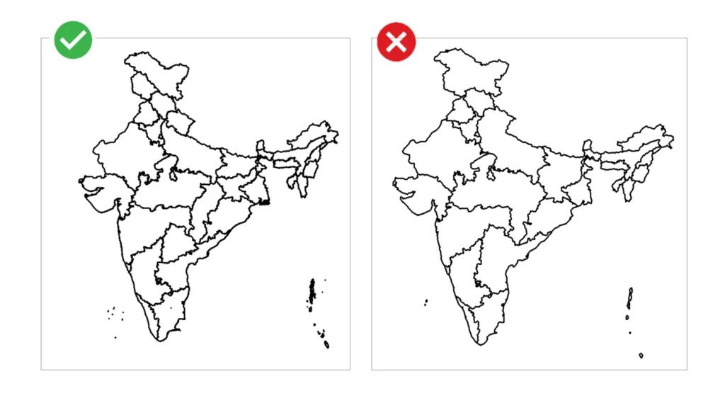
The most common mistake isn’t forgetting these zones but using low-resolution or outdated masks. Using a 2015 road map for a 2026 project is a recipe for failure. If an auditor sees a new settlement or a naturally regenerating forest patch inside your “planting area,” your project’s integrity is compromised.
What Happens When These Errors Slip Through
GIS errors are not just technical hiccups; they are financial and reputational risks. When a project is rejected or requires heavy revision, the consequences are immediate:
- Extended Timelines: Re-mapping can push credit issuance back by a year or more
- Increased Costs: Field teams may need to re-verify boundaries on the ground
- Loss of Trust: Investors and credit buyers lose confidence in the project’s “additionality” and “permanence”
Final Thought: GIS Is a Carbon Project's First Line of Credibility
ARR projects are, at their core, built on trust. You are asking the world to believe that trees planted at specific coordinates will sequester a measurable amount of carbon over decades.
GIS is the system that substantiates that claim.
The errors outlined above are not rare edge cases, they are among the most frequent reasons for project delays. By prioritizing high-quality, multi-seasonal data and rigorous topological checks, you are not just making a map; you are securing the financial and environmental future of your project.
In the carbon market, your map is your bond.